9/30/2009

Weather in Margaret River

Summer can arrive slowly and in cool years it's not really good beach and swimming weather until around Christmas.
The average December day hovers around a maximum 25C, but evenings can be chilly, down around 12C.
There is a rule among locals that it's best to have a jumper in the car at all times.
January and February are the hottest months with the highest temperatures up toward the 40C mark, but seldom higher.
You can expect only five days in January and February to be over 35C, and about 16 when the maximum exceeds 30C.

Often characterised as 'Mediterranean' (especially in tourism circles), the climate of Margaret River passes through four distinct seasons.
One of the cooler parts of the state (given its southerly latitude and exposure to the winds of the Indian Ocean), summer conditions are nowhere near as ferocious as they are further north.
Between December and February, average daily temperatures range between 27C and 29C. Hot northeasterlies from the centre of the continent can also make this the windiest time of the year.


Note:
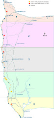
Margaret River lays a bit more inland, we are close to the coast so it will be cooler there.

Pajda's tips

My good friend Pajda did the Cape to Cape walk three years ago, by himself, on the same time of the year; Christmas.
I asked him a few tips:

Hi Wilma!
Good to hear from you!
So, you are going to the big trip! Sound great. All I have to say about this trip is the timing! Well Xmass is the hottest times to walk on sand, but as you know it's possible to do it. Take few liters of waters with you and some good shade as there is nowhere to hide :-(
You can see my pictures here
if you have more questions please contact me :-)
from Pajda


After I've asked Pajda about the flies he answered this:

Sounds like you organised it all pretty well! Should be nice with all that support you have. Flies, hmm I'm not sure now, there was more flies in the outback I think as at the sea front it's quite windy. The hats with flap for sure. Take less to carry with you as the walk on sand is quite...you know 10km stretch of beach ;-) I'm not sure what you imagine to sleep under, but I just had a sleeping bag and slept on plastic sheet - hard but light to carry ;-) Btw. there is a bus going from Augusta to Dunsborough quite often.
good luck with that


Pajda is a great furniture designer, have a look at his website!

9/29/2009

Participants

I've invited everyone who is interested to join us for the walk over Christmas this year. By accepting the invitation you become a participant of this Blog and therefor can add information and post stuff what might be valuable to share but it has to do with the trip!
There are a few people interested in walking one or two days with us as they have Christmas commitments with the family, I would say, the more the merrier so please join!
For the core group, there might be a few who are not into roughing it and like to stay in hostels or rent a caravan in one of the main campgrounds, that's all possible. As long as we know how, when and what we are doing.

I suggest that we can put here some information on who is participating and to give the good example (as one sheep is in the rest will follow) I will start:

INTRODUCTION

My name is Wilma and I love to camp in the bush, I love nature and what is better than combining a workout in nature with your best friends? A few years ago Pajda, a student friend, did the Cape to Cape walk over Christmas and had good stories so when Helen mentioned that she liked to do something together with us during their trip to Australia I suggested the walk and there it started. I mentioned it to some local friends with whom I regularly walk and they got interested as well. I am a good organiser and to get everyone else organised as well I started this blog. So with a bit of luck we have a great trip down south at the end of the year!

Who is next?

Base camp or backpacking?

The total of maps 1-4 is 34 km and that includes Meelup Trail. Without Meelup Trail it's 20.5km and should be enough for the first day.
Plans are still in the making, one of the plans is that we are going to set up a base camp, probably in Boranup forest or maybe at Conto's as people might want to have a shower after a long day of walking. Boranup bush camp has only a toilet.
It depends on how many people are joining us as we need to have a few people providing transport to the start and finish of every track. Stijn is going to stay at the camp and fill his days with surfing and transporting us. Fymo might join him for a few days as well as Sal is on the list of being in and around the base camp as well.
Or we can move camp every day which is not sure yet as we don't know if every camp is reachable by car and migth involve a lot of logistics.
Another idea is to take all the stuff in a backpack and camp along the track in the provided camp spots. This requiers a sweaty backpack including dried and ligthweight food and carrying a lot of water.
We migth do a combination of all, but so far a base camp is my favorite. I like to hear your ideas?

PS, the two guys on the top left photo are Ben and Jake who I know from the outdoor club and they have done the trip in 2008 (check link in the side) but also have some nice pictures here.

Lonely Planet about the track:

Lonely Planet has a big range of books also one on hikes in Australia
These are the six pages about the Cape to Cape track:
Lonely Planet is a worldwide source of inspiration for holidays and they have books about any place including a few on Western Australia so check them out if you need to know more about the area.

Map 19 - the last one!

Goes from Augusta Cliffs North Lookout to Cape Leeuwin Lighthouse - 8.5km
The track follows the coastline parallel to the beach until we reach Quarry Bay, from there it's only a little bit to the end point via the famous old water wheel.

Map 18

Goes from Deepdene Beach to Augusta Cliffs North Lookout - 8km
All along the beach and a bit inland on the end.

Map 17

Goes from Cosy Corner Road to Turner Brook (Deepdene Beach) - 4.5km
To the beach again and following it via Cape Hamelin.

Map 16

Goes from Hamelin Bay to Cosy Corner Road - 5.5km
Around the corner of White Cliff Point a bit further than Hamelin Bay, along the beach for a bit
and than inland again to go parallel on the beach. We will pass a light house.

Map 15

Goes from Boranup Beach to Hamelin Jetty - 9km
Stijn and I did this walk a few years ago, up and down the beach.

Map 14

Goes from Hooley Road junction to Boranup Beach Road - 7km
This inland part includes a little sidetrip to the Boranup Hill loukout. We know this part
very well as we spend a lot of camping trips on Boranup campground which is not far from here. We also know Boranup beach pretty well, as that's where the photos in the logo are made.

Map 13

Goes from Contos Campground to Davies/Hooley Road junction - 6.5km
This is a double map as the walk goes quite a bit inland.

Map 12

Goes from Redgate Beach to Contos Campground - 7km

Map 11

Goes from Prevelly Ridge communications tower to Redgate Beach - 9km
The first part is all inland and than goes further along the beach.

Map 10

From Gnoocardup to Prevelly water tanks/communication tower - 9km
This part goes along the famous Margaret River mouth which we
shouldn't have any difficulties to cross in summer. Margaret River is one of the main touristic attractions of this region.